In the last few years, along with archeological excavations, intensive activities have been carried out for the conservation, restoration and socialization of the prehistoric complex. We hope that soon the prehistoric salt production and urban center Provadia-Solnitsata will be freely accessible to tourists for most of the year.
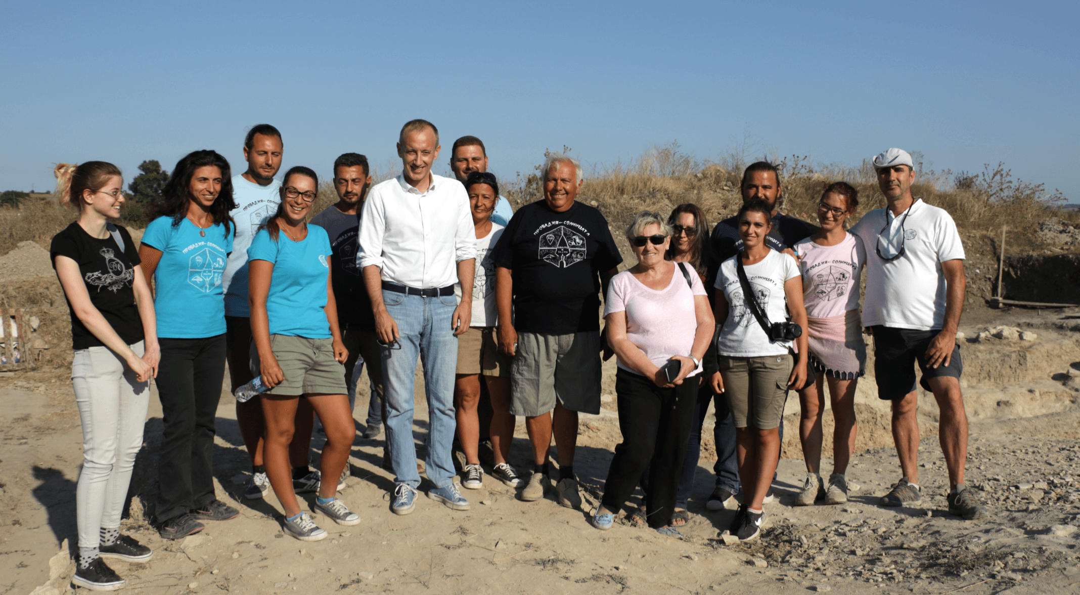
Until then, if you want to visit us, you can do so at a time when the archeological team is on site and continuing the field archaeological research.
In 2023, this will be possible until the end of September.
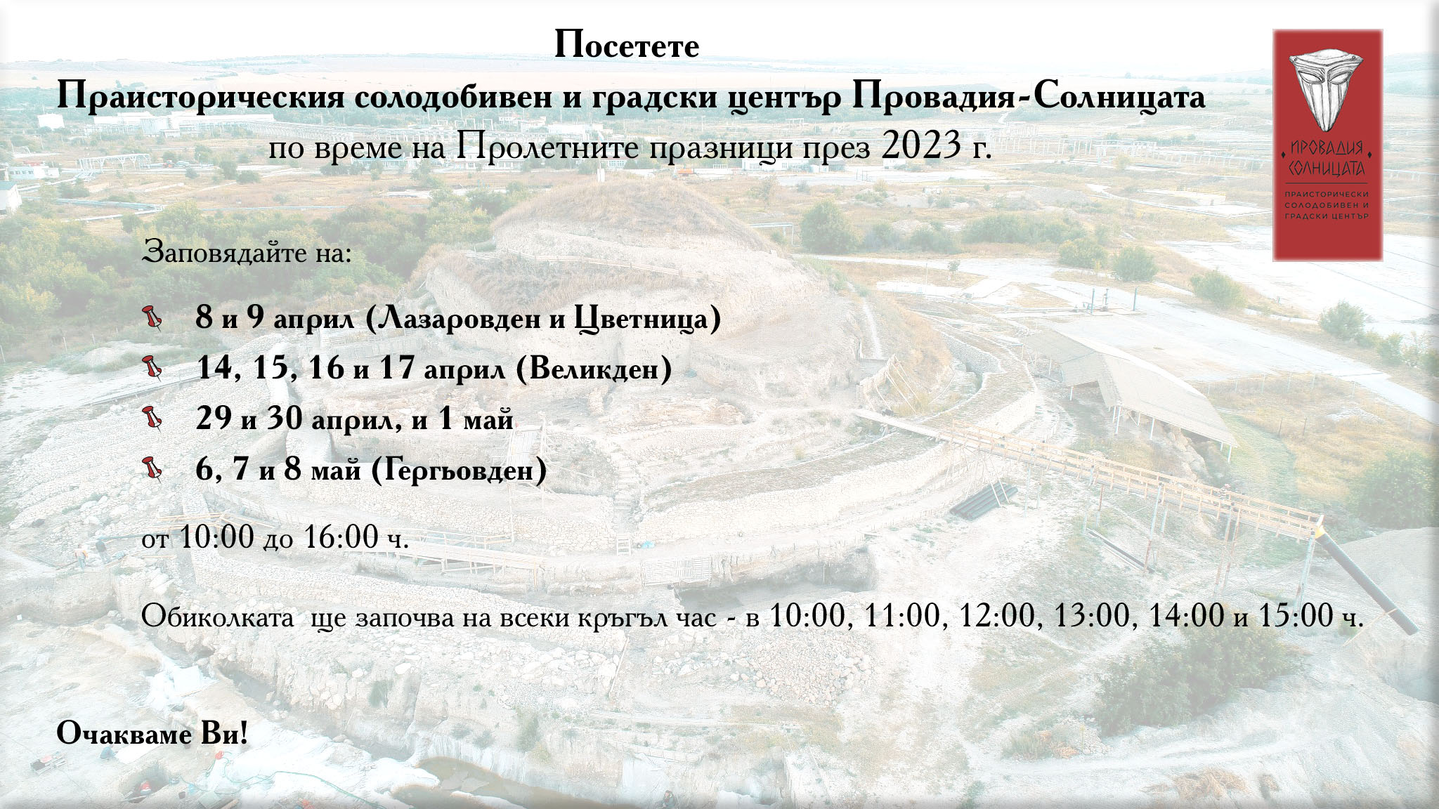
You are welcome to visit us from Monday to Saturday, from 9:00 a.m. to 13:00 p.m., except on rainy days.
The tour starts every round hour - at 9:00, 10:00, 11:00, 12:00 and 13:00 respectively.
The entrance to the archaeological complex is from the south, from the parking lot.
We ask all our guests to have in mind that they come to an archeological site during active research activities. They need to move in a compact group without deviating from the route taken by the guide! Smoking and eating during the visit are undesirable!
The visit is free!
We are expecting you!
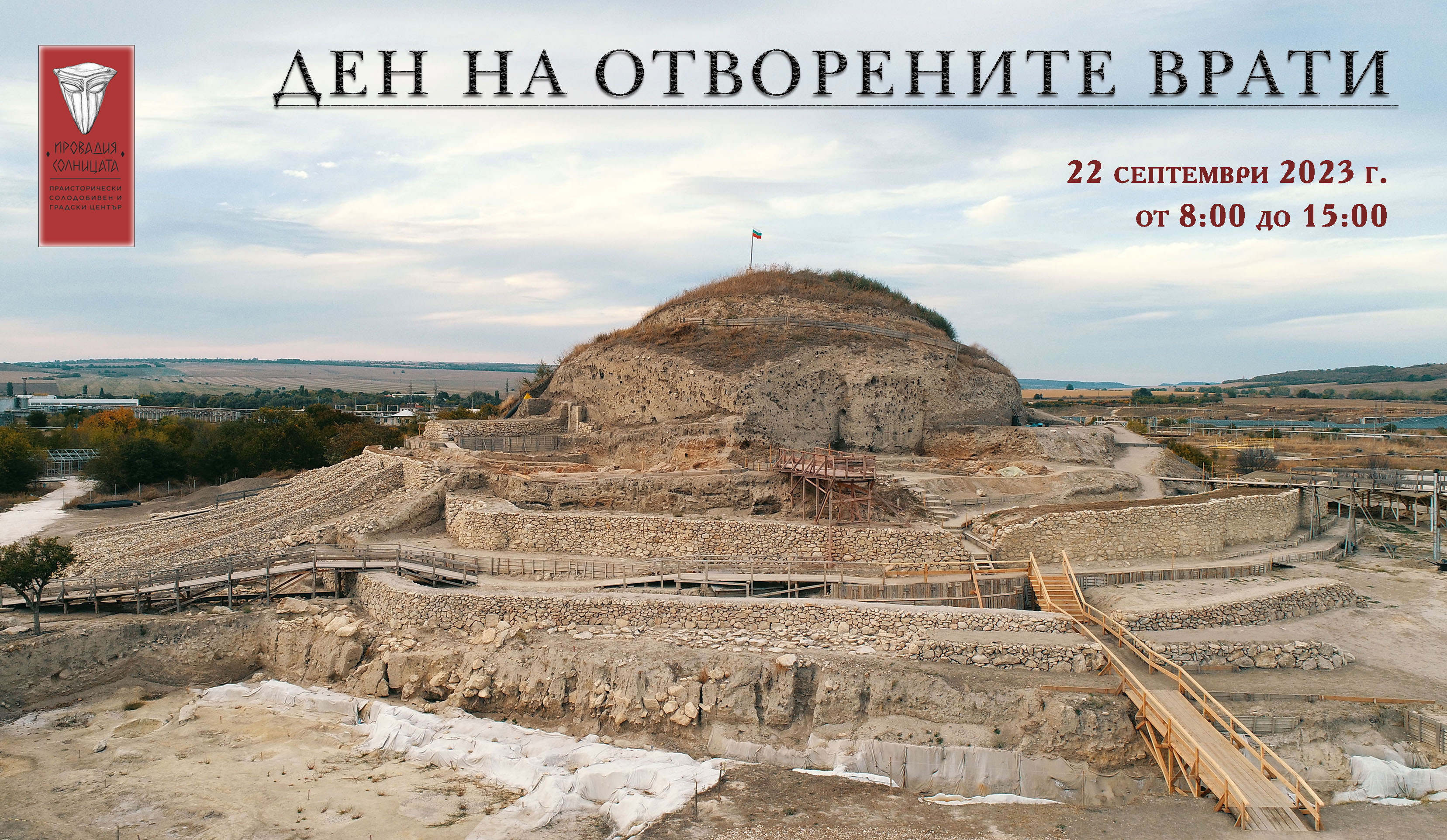
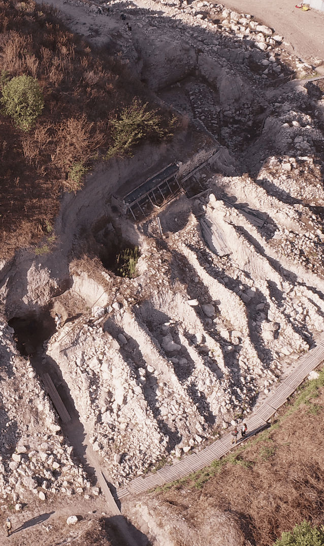
The prehistoric complex Provadia-Solnitsata is located near the modern city of Provadia. It represents the remains of the oldest salt production center in Europe (5600 - 4350 BC), which became the first prehistoric urban center on our continent (4700 - 4350 BC). It consists of: 1. Neolithic-Chalcolithic production complex, 2. Non-fortified and then fortified with stone walls, Chalcolithic settlement (citadel) and a Thracian tomb above it, 3. Late Chalcolithic ritual field (pit sanctuary) 4. Late Chalcolithic necropolis, 5. Middle Chalcolithic necropolis. The site covers an area of about 300 acres. The emergence and development of the complex are directly related to its location on top of the largest and in fact the only deposit of rock salt in the Eastern Balkans- the so-called Mirov salt field. This brief description of the archaeological site is based on 16 years of fieldwork (2005 - 2020) and defines it as one of the most significant prehistoric sites in Southeastern Europe. Currently, Provadia-Solnitsata is a very attractive site to visit, after conservation and restoration has been undertaken.
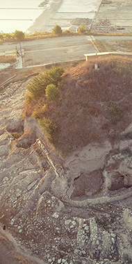
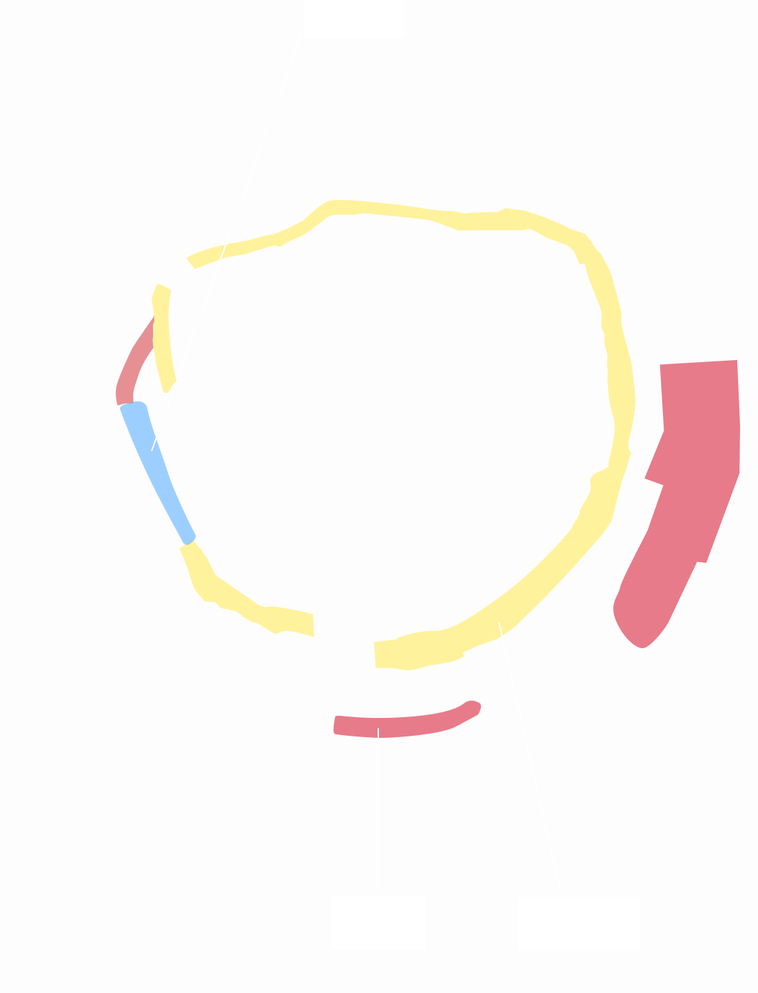
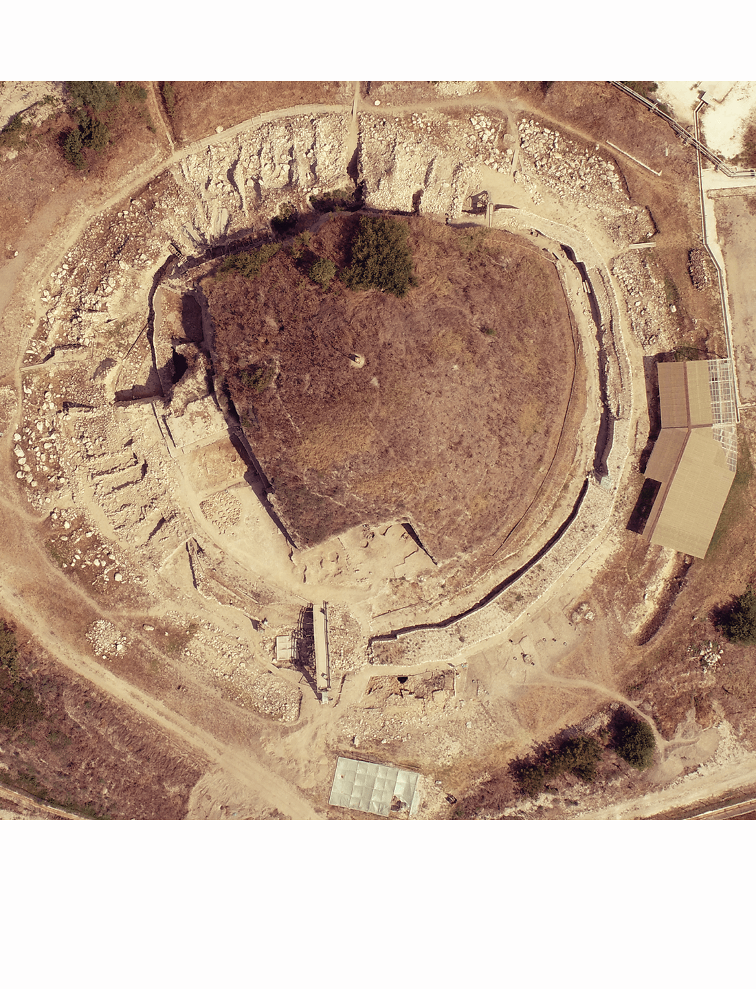
The intensive production of salt in the middle and second half of the 5th millennium BC. makes the inhabitants of Provadia-Solnitsata one of the richest people in Europe. At that time salt played the role of money and was more valuable than gold. Salt trade led to the accumulation of vast wealth, which had to be guarded from constant attacks by hostile neighbors. Around 4700 BC the settlement was guarded by a strong stone fortification system that was rebuilt and maintained for 350 years. So far, there is no evidence of similar stone citadel dated back to the 5th millennium BC in Europe, which makes it an incredible achievement of military thought and construction! The first defense system was severely damaged twice from earthquakes, forcing the inhabitants of Provadia-Solnitsata to build a new, extremely massive stone structure around 4600 BC. The fortress has an irregularly rounded shape with a total length of about 234 m and a total area of about 4 decares, and is erected entirely from unworked stones. In some places, the height of the wall is preserved up to 3.50 m. Its base thickness is between 2.40 and 4.30 m, the greater portion of it is between 3 and 3.40 m, which suggests that its real height was 5 - 6 m! One of the gates of the fortress was to the northeast - opposite the production center, which facilitated the rapid gathering of the produced salt within the protected space. About 4500 - 4400 BC. the second stone wall was destroyed by an earthquake or military conflict, but the event was certainly accompanied by a strong fire. However, much of the majestic stone structure has been preserved for millennia and still impresses anyone who has the opportunity to see it.
A third stone defense system was built by the inhabitants of one of the last late-Chalcolithic settlements (about 4450 BC). It is a complex fortification system consisting of three elements and is regarded as an incredible achievement in military construction art. The first element of this system is the so-called 'stone casing', which has a dual function, namely to strengthen the slope of the already accumulated settlement mound and impede the movement of potential attackers. The second element is the stone clusters of larger and smaller stones along sloping lines or the so-called ‘radial walls’. They start from the highest part of the slope and reach the periphery of the settlement. They are relatively dense, about 1 - 2 m apart. They had the difficult task of breaking the attacking armies into smaller groups of two or three people, forming a kind of corridors that prevented a mass attack on the slope. At the highest part of this impressive system, was situated the massive 3rd stone wall that rose impressively above the surrounding terrain. At this point, we’ve discovered 21 radial lines, located in the western and northern part of the settlement- the rest have been destroyed in a later period.

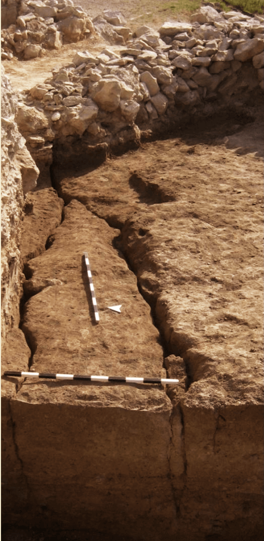
A study of a large-scale building dating back to the Middle Chalcolithic (4700 - 4600 BC) in the southern periphery of the settlement revealed that it was devastated by a severe natural fire. Among the ruins, we found many ceramic vessels made of clay, piles of scattered, various charred grains. In the southeast of the house was laid the foundation of a large domed oven, along with a stone mill attached to it to grind grain. In addition, when the thick clay ceiling that was made with a reinforcement timber joist fell, it broke into pieces and squeezed ceramic vessels and other objects from the first floor. The numerous fragmented ceramic vessels (up until now - 27) found between the destructed elements and the floor of the building, and the large amount of charred grain scattered in the eastern half of the remains of the house, indicate that people were forced to abandon some of their food supplies and property... All this suggests that the fire was an accident and the ancient inhabitants did not have time to move their inventory. The fire is highly likely to have been caused by a high-magnitude earthquake. Evidence of significant strong seismic events in the 46th century BC. have been recorded within the settlement in previous archeological seasons as well. We’ve traced numerous cracks caused by earthquakes in the floor of a neighboring house.
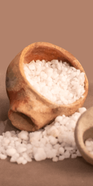
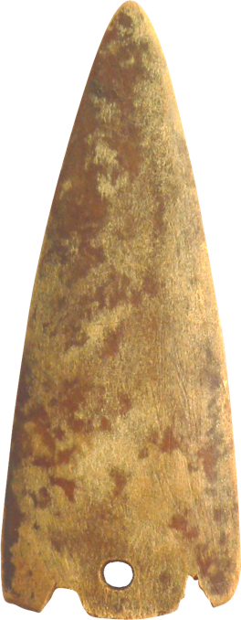
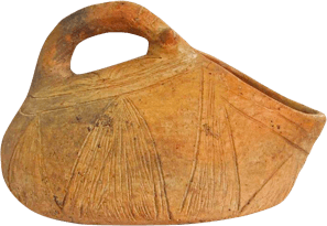
The “Provadia-Solnitsata” Mound, which preserves the remains of everyday life of the most ancient salt producers on the European continent, was abandoned by its inhabitants around 4350 BC. The reasons must be sought in climatic changes that resulted in а drought and the drying up of the salt springs which provided the raw material for the extraction of salt. After more than 4,000 years, a Thracian aristocrat settled on the 9 m high settlement mound, and a little later began covering the prehistoric remains with an embankment of a huge Thracian mound about 13 m high. That is why for a long time, our archaeological studies could not reach the remains of the prehistoric settlement, but in recent years we have been able to investigate part of the tomb mound embankment and reach the remains of at least three houses from the last prehistoric settlement. Whether they are hiding traces of dramatic events is yet to be revealed. For sure, the material traces of the lives of the last salt producers will be very interesting - like this ceramic vessel, which is about 6300 years old, found in one of the houses.
The settlement mound had a cultural stratum about 9 m thick and 105 m in diameter. During the Late Hellenistic Age (2nd - 1st c. BC) there was a "ruler’s mansion" fortified with stone-brick walls. Immediately after that, a tomb was accumulated during the Roman era, which gives the monument a total height of 22 m.


The intensive production of salt in the middle and second half of the 5th millennium BC. makes the inhabitants of Provadia-Solnitsata one of the richest people in Europe. At that time salt played the role of money and was more valuable than gold. Salt trade led to the accumulation of vast wealth, which had to be guarded from constant attacks by hostile neighbors. Around 4700 BC the settlement was guarded by a strong stone fortification system that was rebuilt and maintained for 350 years. So far, there is no evidence of similar stone citadel dated back to the 5th millennium BC in Europe, which makes it an incredible achievement of military thought and construction! The first defense system was severely damaged twice from earthquakes, forcing the inhabitants of Provadia-Solnitsata to build a new, extremely massive stone structure around 4600 BC. The fortress has an irregularly rounded shape with a total length of about 234 m and a total area of about 4 decares, and is erected entirely from unworked stones. In some places, the height of the wall is preserved up to 3.50 m. Its base thickness is between 2.40 and 4.30 m, the greater portion of it is between 3 and 3.40 m, which suggests that its real height was 5 - 6 m! One of the gates of the fortress was to the northeast - opposite the production center, which facilitated the rapid gathering of the produced salt within the protected space. About 4500 - 4400 BC. the second stone wall was destroyed by an earthquake or military conflict, but the event was certainly accompanied by a strong fire. However, much of the majestic stone structure has been preserved for millennia and still impresses anyone who has the opportunity to see it.
A third stone defense system was built by the inhabitants of one of the last late-Chalcolithic settlements (about 4450 BC). It is a complex fortification system consisting of three elements and is regarded as an incredible achievement in military construction art. The first element of this system is the so-called 'stone casing', which has a dual function, namely to strengthen the slope of the already accumulated settlement mound and impede the movement of potential attackers. The second element is the stone clusters of larger and smaller stones along sloping lines or the so-called ‘radial walls’. They start from the highest part of the slope and reach the periphery of the settlement. They are relatively dense, about 1 - 2 m apart. They had the difficult task of breaking the attacking armies into smaller groups of two or three people, forming a kind of corridors that prevented a mass attack on the slope. At the highest part of this impressive system, was situated the massive 3rd stone wall that rose impressively above the surrounding terrain. At this point, we’ve discovered 21 radial lines, located in the western and northern part of the settlement- the rest have been destroyed in a later period.
A study of a large-scale building dating back to the Middle Chalcolithic (4700 - 4600 BC) in the southern periphery of the settlement revealed that it was devastated by a severe natural fire. Among the ruins, we found many ceramic vessels made of clay, piles of scattered, various charred grains. In the southeast of the house was laid the foundation of a large domed oven, along with a stone mill attached to it to grind grain. In addition, when the thick clay ceiling that was made with a reinforcement timber joist fell, it broke into pieces and squeezed ceramic vessels and other objects from the first floor. The numerous fragmented ceramic vessels (up until now - 27) found between the destructed elements and the floor of the building, and the large amount of charred grain scattered in the eastern half of the remains of the house, indicate that people were forced to abandon some of their food supplies and property... All this suggests that the fire was an accident and the ancient inhabitants did not have time to move their inventory. The fire is highly likely to have been caused by a high-magnitude earthquake. Evidence of significant strong seismic events in the 46th century BC. have been recorded within the settlement in previous archeological seasons as well. We’ve traced numerous cracks caused by earthquakes in the floor of a neighboring house.
The “Provadia-Solnitsata” Mound, which preserves the remains of everyday life of the most ancient salt producers on the European continent, was abandoned by its inhabitants around 4350 BC. The reasons must be sought in climatic changes that resulted in а drought and the drying up of the salt springs which provided the raw material for the extraction of salt. After more than 4,000 years, a Thracian aristocrat settled on the 9 m high settlement mound, and a little later began covering the prehistoric remains with an embankment of a huge Thracian mound about 13 m high. That is why for a long time, our archaeological studies could not reach the remains of the prehistoric settlement, but in recent years we have been able to investigate part of the tomb mound embankment and reach the remains of at least three houses from the last prehistoric settlement. Whether they are hiding traces of dramatic events is yet to be revealed. For sure, the material traces of the lives of the last salt producers will be very interesting - like this ceramic vessel, which is about 6300 years old, found in one of the houses.
The settlement mound had a cultural stratum about 9 m thick and 105 m in diameter. During the Late Hellenistic Age (2nd - 1st c. BC) there was a "ruler’s mansion" fortified with stone-brick walls. Immediately after that, a tomb was accumulated during the Roman era, which gives the monument a total height of 22 m.